 Top Stories
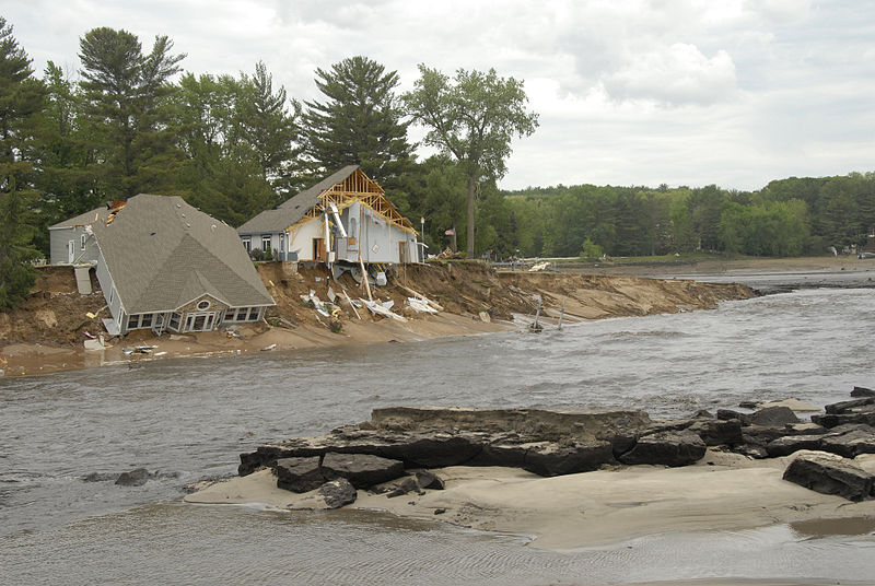
Top Scientists Warn of Catastrophic Sea Level Rise
-
- *Flooding caused by Hurricane Sandy, **Photo: BR Birke -- CC 2.0*
Dr. James Hansen, who was the lead climate scientist at NASA, and sixteen
other ...


 Visitors
Showing posts with label Weather. Show all posts
Showing posts with label Weather. Show all posts
FEATURE
A New Climate Reality: What Happens Now?
AnswerTips-Enabled
by Janet Ritz

"The world changes so fast, it's difficult to see it in context. Scientists watch from a mathematical point of view, points on a graph, comparative analyses, blips on radar from sensors slapped on the bows of ships. Dry bits of brain matter fight the brain freeze caused by information overload of drought in the Southwest, typhoon-caused floods in Bangladesh, tornadoes in the Midwest, and where's all that snow coming from? It begins to look horrifyingly familiar: one person's agony is another's data."
That may change. A year ago, the world shivered in unexpected blizzards the scientists warned were like a defrosting freezer as the cold air of the warming arctic rushed south. Just wait until next year, the caution came, when enough of the ice is gone and we really start to heat up.
NPR tackled this recently on an episode of Fresh Air entitled: "Sunny Days are Here Again -- But is that Good?" where they posit that the early spring is more than just warm weather. Continued...
FEATURE
Missouri Tornado Chasers' Raw Footage
AnswerTips-Enabled
Tornado chasers captured the Joplin, Missouri tornado on video as it developed on the ground and then drove through the aftermath minutes following the destruction.
One hundred sixteen people have been reported killed with more missing and injured. The death toll is expected to rise. Joplin's main hospital took a direct hit. One-third of the city suffered catastrophic damage.
JOPLIN, Mo. (AP) - A massive tornado that tore a six-mile path across southwestern Missouri killed at least 116 people as it smashed the city of Joplin, ripping into a hospital, crushing cars and leaving behind only splintered tree trunks where entire neighborhoods once stood.
Authorities warned that the death toll could climb as search-and-rescue workers continued their efforts. Their task was made more miserable early Monday by a new thunderstorm that brought strong winds, heavy rain and hail.
More tornadoes touched down throughout the Midwest, with damage reported in Kansas, Minnesota and Oklahoma, as well as in Missouri. Dangerous weather is expected to continue across the region.
A brief moment of light with a rare double rainbow following the tornado:
How you can help.
FEATURE
Tornado Victims Struggle to Cope with Damage
AnswerTips-Enabled

Tuscaloosa lost a 5.9 mile stretch of their city of 100,000. They lost their city services. President Obama arrived today. He expressed his heartbreak at the loss of life and pledged emergency funds, full support with FEMA, and ways to coordinate through HUD to rebuild.
Officials are calling the tornado swarm to hit the Southeast, US, the 'worst national disaster since Katrina.' Jack Hayes, the director of the National Weather Service is not calling this climate change. He cited prolonged flow of more humid air from the Gulf with a strong Jet Stream from Canada. Heated air was the triggering catalyst.
Massive tornadoes hit populated cities head-on. Forecasters had warned of an "insane" storm system for days, so it's unlikely that the tornadoes caught many by surprise. But with few basements in Dixie Alley, not many places were safe in the paths of tornadoes that had nearly 200-mph (322-kph) winds. Even solidly built houses were swept away. Many entire neighborhoods were completely obliterated.
Though rare, extreme tornadoes have touched down in the southeast in the past. Hayes could not rule out climate change as a factor in the severity or sheer number of tornadoes. April has been one of the worst for tornado deaths in U.S. history. The deciding factor will have to be established over a period of years (climate vs. weather patterns) to determine if the warming of the climate was the catalyst in this extreme event and whether they will continue to grow in frequency.
Some of the storms were a mile wide with wind speeds for over 200 miles per hour (EF5). The people of the Southeast don't have to wonder whether the climate has become unstable. They are at effect of it. Whether it will continue, their need is now. Red Cross Link.
FEATURE
Super Typhoon Megi Hits the Philippines - Strongest Typhoon at Landfall on Record
AnswerTips-Enabled

(CNN) -- Super Typhoon Megi has made landfall in the northern Philippines, the national weather agency said Monday. Megi, also known as Typhoon Juan, made landfall near Sierra Madre on Luzon island, according to the Philippine Atmospheric, Geophysical & Astronomical Services Administration (PAGASA). It has maximum sustained winds of about 225 kph (140 kph) and gusts of up to 260 kph (162 mph).
[ [1] 2 ] read more and link to videos →
FEATURE
Hurricane Earl Intensifies into Massive Storm (Video)
AnswerTips-Enabled

NASA has provided footage of Hurricane Earl from the Space Station. The Hurricane has grown so large that it is expected to do some damage as far north as New England even without landfall. The governors of North Carolina, Maryland and Virginia have declared a state of emergency. President Obama has declared a national state of emergency for North Carolina. Mandatory evacuations are underway. Other states are expected to follow suit once there is more certainty of its path. Continued...
[ [1] 2 ] read more and link to video →
FEATURE
The Planet Has a Fever
AnswerTips-Enabled

Have you felt it? The sweltering summer that has strained the grid? The floods and tornadoes and the hail? The increased humidity where it was a dry heat? The dry heat where it was moist?
The planet has a fever. That's not supposition. The National Climactic Data Center of the National Oceanic and Atmospheric Administration (NOAA) has recorded year-to-date combined global and and surface temperatures that are the warmest on record.
• The combined global land and ocean surface temperature for April-June 2010 was 1.26°F (0.70°C) above the 20th century average—the warmest April-June period on record.
• For the year-to-date, the global combined land and ocean surface temperature of 57.5°F (14.2°C) was the warmest January-June period. This value is 1.22°F (0.68°C) above the 20th century average.
• June 2010 was the fourth consecutive warmest month on record (March, April, and May 2010 were also the warmest on record). This was the 304th consecutive month with a global temperature above the 20th century average. The last month with below-average temperature was February 1985.
• It was the warmest June and April–June on record for the Northern Hemisphere as a whole and all land areas of the Northern Hemisphere.
• Arctic sea ice continued its annual decline, typically reaching a September minimum. Similar to May 2010, the Arctic sea ice continued to decline at a record rapid rate—the fastest measured for June (more than 50 percent greater than average). Continued...
[ [1] 2 ] read more...
FEATURE
NOAA Expects Busy Atlantic Hurricane Season
AnswerTips-Enabled

An “active to extremely active” hurricane season is expected for the Atlantic Basin this year according to the seasonal outlook issued today by NOAA’s Climate Prediction Center – a division of the National Weather Service. As with every hurricane season, this outlook underscores the importance of having a hurricane preparedness plan in place.
Across the entire Atlantic Basin for the six-month season, which begins June 1, NOAA is projecting a 70 percent probability of the following ranges:
Across the entire Atlantic Basin for the six-month season, which begins June 1, NOAA is projecting a 70 percent probability of the following ranges:
• 14 to 23 Named Storms (top winds of 39 mph or higher), including:
• 8 to 14 Hurricanes (top winds of 74 mph or higher), of which:
• 3 to 7 could be Major Hurricanes (Category 3, 4 or 5; winds of at least 111 mph)
“If this outlook holds true, this season could be one of the more active on record,” said Jane Lubchenco, Ph.D., under secretary of commerce for oceans and atmosphere and NOAA administrator. “The greater likelihood of storms brings an increased risk of a landfall. In short, we urge everyone to be prepared.” Continued...
[1] [2] read more...
Global Temperature Trends: 2008 Annual Summation
AnswerTips-Enabled
The map of global temperature anomalies in 2008, Figure 1 (right), shows that most of the world was either near normal or warmer than in the base period (1951-1980). Eurasia, the Arctic and the Antarctic Peninsula were exceptionally warm, while much of the Pacific Ocean was cooler than the long-term average. The relatively low temperature in the tropical Pacific was due to a strong La Nina that existed in the first half of the year. La Nina and El Nino are opposite phases of a natural oscillation of tropical temperatures, La Nina being the cool phaseby James Hansen, Makiko Sato, Reto Ruedy, Ken LoThe Goddard Institute for Space Studies has analyzed the global temperature trends based on 2008 surface air temperature leading to the conclusion that, despite the cold brought on by the strong La Nina event last year, 2008 was the ninth warmest year since measurements began in 1880. [1] [2] read more...
Hurricane Ike: Worse Case Scenario Forecasted
AnswerTips-Enabled
The unusually strong wording came in a weather advisory regarding storm surge along the shoreline of Galveston Bay, which could see maximum water levels of 15 to 22 feet, the agency said. "All neighborhoods ... and possibly entire coastal communities ... will be inundated during the period of peak storm tide," the advisory said. "Persons not heeding evacuation orders in single-family one- or two-story homes will face certain death." Weather service warnings do not often include the words "Certain death." This will be a flooding storm. If it turns out to cause less damage than predicted, that means property not expected to survive might. If it turns out to be as predicted, anyone in its path that cannot get above 22 feet of fast moving water will be washed away. Continued...
Residents living in single-family homes in some parts of coastal Texas face "certain death" if they do not heed orders to evacuate ahead of Hurricane Ike's arrival, the National Weather Service said Thursday night.
There are concerns about people ignoring the mandatory evacuation order due to "hurricane fatigue." This 700 mile-wide storm may not be the event upon which to take that chance.
Here are some facts:

[1] [2] read more...
FEATURE
NOAA makes it official: Extreme weather due to climate change
AnswerTips-Enabled
by Janet Ritz
 In a report issued by the U.S. Climate Change Science Program, a joint effort of more than a dozen government agencies -- including the National Oceanic and Atmospheric Administration -- the conclusion is that the extreme weather we've been experiencing will become more extreme and is due to climate change.
 WASHINGTON - Droughts will get drier, storms will get stormier and floods will get deeper with a warming climate across North America, U.S. government experts said in a report billed as the first continental assessment of extreme events.
Events that have seemed relatively rare will become commonplace, said the latest report from the U.S. Climate Change Science Program, a joint effort of more than a dozen government agencies.
 Specific future projections include:
* Abnormally hot days and nights, along with heat waves, are very likely to become more common.
* Cold nights are very likely to become less common.
* Sea ice extent is expected to continue to decrease and may even disappear in the Arctic Ocean in summer in coming decades.
* Precipitation, on average, is likely to be less frequent but more intense.
* Droughts are likely to become more frequent and severe in some regions.
* Hurricanes will likely have increased precipitation and wind.
* The strongest cold-season storms in the Atlantic and Pacific are likely to produce stronger winds and higher extreme wave heights.
The report, issued by the Department of Commerce in accordance with Section 515 of the Treasury and General Government Appropriations Act for Fiscal Year 2001 was produced to be in compliance with that act in conjunction with NOAA.
For purposes of compliance with Section 515, this CCSP Synthesis and Assessment Product is an “interpreted product” as that term is used in NOAA guidelines and is classified as “highly influential.”
 Which means the report cannot require regulatory action, though it can (and should) influence it. From the NOAA press release:
 The U.S. Climate Change Science Program and the Subcommittee on Global Change Research today released a scientific assessment that provides the first comprehensive analysis of observed and projected changes in weather and climate extremes in North America and U.S. territories. The Intergovernmental Panel on Climate Change previously evaluated extreme weather and climate events on a global basis in this same context. However, there has not been a specific assessment across North America prior to this report.That's official. The extreme weather the U.S. has been experiencing is due to climate change and is expected to become more extreme in the future.
Among the major findings reported in this assessment are that droughts, heavy downpours, excessive heat, and intense hurricanes are likely to become more commonplace as humans continue to increase the atmospheric concentrations of heat-trapping greenhouse gases.
[1] [2]
FEATURE
Severe storms to hit Britain
AnswerTips-Enabled
 Residents across the United Kingdom have been warned to take cover Sunday as rare June gales are forecast to batter England, Scotland, Ireland and Wales with abnormally strong winds and rain.
 The Environmentalist's World Wide Weather page has the graphic below, which is a dynamic, real time feed from the British Met(eorological) Office. Click for further details:The storms - with winds which could reach 65mph across northern Britain - are expected to peak around midday.
The worst affected areas are expected to be north Wales and northern England, but Northern Ireland and southern Scotland may also be affected.
BBC forecaster Tomasz Schafernaker said the weather was abnormal for June.
FEATURE
U.S. Floods a Sign of Things to Come
AnswerTips-Enabled
Reprint of article originally published on 3/21/08 forecasting current floods
Cross-posted on Reuters, USA Today, FoxNews, IBS, Atlanta Journal-Constitution
 The National Oceanic and Atmospheric Administration (NOAA) has issued a report that states the flooding we're seeing in the U.S. heartland is a sign of things to come.
Major floods striking America’s heartland this week offer a preview of the spring seasonal outlook, according to NOAA’s National Weather Service. Several factors will contribute to above-average flood conditions, including record rainfall in some states and snow packs, which are melting and causing rivers and streams to crest over their banks. This week, more than 250 communities in a dozen states are experiencing flood conditions.“We expect rains and melting snow to bring more flooding this spring,” said Vickie Nadolski, deputy director of NOAA’s National Weather Service. “Americans should be on high alert to flood conditions in your communities. Arm yourselves with information about how to stay safe during a flood and do not attempt to drive on flooded roadways – remember to always turn around, don’t drown.”
The heavy precipitation may be related to the La Nina effect, as reported by the British Met(eorological) Office in this report. NOAA gives these reasons for the flood conditions:
- Above-normal flood potential is evident in much of the Mississippi River basin, the Ohio River basin, the lower Missouri River basin, Pennsylvania, New Jersey, most of New York, all of New England, and portions of the West, including Colorado and Idaho.
- Heavy winter snow combined with recent rain indicates parts of Wisconsin and Illinois should see minor to moderate flooding, with as much as a 20 to 30 percent chance of major flooding on some rivers in southern Wisconsin and northern Illinois.
Current snow depth in some areas of upstate New York and New England is more than a foot greater than usual for this time of the year, which increases flood potential in the Connecticut River Valley.
- Locations in the mountains of Colorado and Idaho have 150 to 200 percent of average water contained in snowpack leading to a higher than normal flood potential.


NOAA has also updated their Spring Drought Outlook with the following...
FEATURE
What's with the Weather? The La Niña-Tornado Connection
AnswerTips-Enabled
by Janet Ritz
Cross-posted on The Huffington Post, Reuters 2008 has seen a record outbreak of tornadoes in the United States from California to the Midwest, from the South through the central plains, to the Appalachian states.
In January, THE ENVIRONMENTALIST reported the University of East Anglia's prediction for a strong 2008 La Niña event.
"The assessment for 2008 is that there will be a strong La Niña event in the Pacific, which will limit the warming trend for the year (whilst still being one of the warmest years)."
The La Niña phenomenon is an upwelling of colder waters resulting in a change in ocean temperature that causes a shift in the jet stream, reducing corresponding climate temperature. A NOAA study from October, 1999, still referenced on their site, which uses data from 1950 through 1996, concluded there was no tornadic connection to the El Niño/La Niña event. Since then, however, Joseph Schaefer, Director of NOAA's National Weather Service's Storm Prediction Center, according to this February MSNBC report, has revised his position:
Tornadoes do happen in February, but a study by Schaefer two years ago found that winter tornadoes in parts of the South occur more frequently and are stronger when there is a La Niña.
 The La Niña connection was also cited in a Purdue University study reported in Science Daily (also from 1999), this one with data from 1916 to 1996, which offered the intriguing possibility that the La Niña event could be traced to a geographical shift in tornadic activity
[1] [2]
FEATURE
Starvation warning for Burma/Myanmar's Children
AnswerTips-Enabled

"We are extremely worried that many children in the affected areas are now suffering from severe acute malnourishment, the most serious level of hunger," said Jasmine Whitbread, who heads the agency's operation in Britain. "When people reach this stage, they can die in a matter of days."
International outrage has been growing at the Myanmar Junta's obstructive behavior and unwillingness to allow experts and aid into the devastated region. This has prompted the U.N. Secretary General, Ban Ki-moon, to send U.N. humanitarian chief John Holmes to Myanmar this weekend. "He's going at the request of the secretary-general to find out what's really going on the ground, to get a much better picture of how the response is going and ... to see how much we can help them scale up this response," [Amanda Pitt, a U.N. spokeswoman in Bangkok] said. Details of the visit, she said, were still being worked out.
There have been reports of the Junta taking the limited aid that has been allowed in and distributing it to those associated with their regime, stockpiling it in warehouses and/or selling it at inflated prices on the Yangon market.
The U.N. report said all communications equipment used by foreign agencies must be purchased through Myanmar's Ministry of Posts and Communications -- with a maximum of 10 telephones per agency -- for US$1,500 (euro960) each. Importing equipment is not allowed.
Britain's prime minister has directly accused the Junta of preventing aid from reaching victims and said "the military regime cares more about its own survival than it's people's welfare."
"This is inhuman," Gordon Brown stated.
French and U.S. supply ships, including the fully stocked USS Essex, with its scores of helicopters and Marines trained in disaster relief, have been anchored off the Burmese coast awaiting permission to bring their supplies directly to the 2.5 million failing survivors. Authorization has not been forthcoming...[1] [2]

FEATURE
Myanmar/Burma's Cyclone Catastrophe: est. 100,000 killed, million homeless
AnswerTips-Enabled
by The Environmentalist Staff
Cross-posted on the Chicago Sun-Times, Reuters
 Cyclone Nargis' ten hour devastation of Myanmar/Burma last Saturday is quickly emerging as a humanitarian catastrophe, leading their repressive and secretive military junta to take the unprecedented step of requesting international aid, while resisting granting the visas to allow those aid agencies and government organizations the access needed to bring those supplies to the impacted areas.
Reports of Cholera and Malaria in the cyclone zone have now been confirmed. The U.S. was able to land one transport plane with mosquito nets and water purification supplies. The Myanmar Junta has said they will let two more planes in. Concern is growing that the regime is either keeping the supplies for themselves, distributing them only to those with relatives in the military or otherwise connected to the regime and/or selling them on the inflated open market.
(NGO's accepting donations for this disaster: World Vision, Red Cross Red Crescent, America Burma Buddhist Assoc., Global Giving, Doctors without Borders, UN World Food Program).
YANGON, Myanmar (CNN) -- The death toll from the Myanmar cyclone is more than [new U.N. estimate: 100,000] people, Myanmar's Foreign Ministry said Monday. Survivors were facing their third night without electricity in the aftermath of the historic cyclone that also clogged roads with thousands of downed trees. Diplomats were summoned to a government briefing Monday as the reclusive southeast Asian country's ruling military junta issued a rare appeal for international assistance in the face of an escalating humanitarian crisis.The people of Burma/Myanmar only learned of the impending disaster through outside news sources, such as Radio Free Asia and Voice of America -- which left them without enough time to prepare for the cyclone. There are reports of growing numbers of dead and homeless (rumored six figures), with an estimated ten thousand killed in one town alone:A state of emergency was declared across much of the country following the 10-hour storm that left swathes of destruction in its wake.
The hardest-hit area was the Irrawaddy region where about 10,000 people died in Bogalay, 90 kms (55 miles) southwest of Yangon.
Aid agencies gathered in nearby Thailand are trying to work out access to the country with the regime. International calls to allow access to aid workers have fallen on deaf ears with the military junta. A U.S. carrier group that is in the Bay of Thailand to conduct, ironically, disaster relief exercises, could have helicopters with relief supplies and experts in the effected areas within hours, but thus far, has not received permission from the Myanmar regime to land.
The U.S. government is now asking China, a Myanmar trading partner, to get the reclusive regime to grant permission. These attempts, thus far, have been unsuccessful, leaving the USS Essex and its tons of relief supplies, marines and disaster relief experts to watch the growing humanitarian disaster in horror and frustration.
“Stories get worse by the hour,” one Yangon resident, who did not want to be identified for fear of government retribution, said in an e-mail message. “No drinking water in many areas, still no power. Houses completely disappeared. Refugees scavenging for food in poorer areas. Roofing, building supplies, tools — all are scarce and prices skyrocketing on everything.”The U.N. Secretary General has issued a statement to say that he was "deeply saddened by the loss of life and the destruction suffered by the people of Myanmar" and has promised international support. No word, as yet, from the Myanmar regime's main trading partner, China, or from the oil and gas companies that do business with them.
Scenes of the destruction showed extensive flooding, boats on their sides in Yangon harbor, roofs ripped off buildings, uprooted trees and downed power lines after cyclone Nargis battered the Irrawaddy delta with 150 mile (241 km) an hour winds throughout Friday night and Saturday morning, dumping 20 inches of rain.The death toll and ongoing humanitarian crisis within the already devastatingly poor population is expected to worsen as are the tensions between the government and their opponents, led by the country's Buddhist monks, whose protests against the junta were put down with violence last fall.
President Bush has pleaded with the junta to "let the United States come in and help you."
First Lady, Laura Bush, in a rare press conference, announced: "Although they were aware of the threat, Burma’s state-run media failed to issue a timely warning to citizens in the storm’s path,” Mrs. Bush said in a rare news conference at the White House. “It’s troubling that many of the Burmese people learned of this impending disaster only when foreign outlets, such as Radio Free Asia and Voice of America, sounded the alarm."
The American Embassy in Myanmar has authorized the release of $250,000 [now $3 million] in immediate emergency aid, and Mrs. Bush promised, “More aid will be forthcoming."
Within Burma/Myanmar, the price of gas has soared to $10 per gallon. Food staple costs have risen out of reach of the population. This has led to growing anger across southeast Asia, as the evidence mounts that the regime was not only unprepared for the disaster...
[1] [2]
FEATURE
'The Warm Air is Very Active This Year'
AnswerTips-Enabled
by Janet Ritz
Cross-posted on USAToday"The warm air is very active this year." So says Li Weijing, deputy director-general of China's National Climate Center, in reference to the massive snowstorm that has paralyzed his country.
The cause for the Chinese storms has been ascribed to the La Niña weather pattern, as forecast by the British Met (Meteorological) Office. La Niña is a cooling pattern that is influenced and enhanced by warming trends:
La Nina enhances Arctic weather systems and causes a cold winter in Asia, including in China. As warm and moisture air from the south meets cold air in the north under freezing temperatures, snow forms.